Homeowners, Landowners, Engineers and Developers
May be in need of Land Surveying services such as:

- ALTA/NSPS Land Title Surveys
- Topographic Surveys
- Boundary Surveys
- Easement Surveys
- Lot Splits
- Lot Combinations
- Minor Land Divisions
- Map of Dedications
- Subdivision Platting
- Legal Descriptions & Exhibits
- Elevation Certificates
- Construction Staking services
If you are planning an addition to your property, building a wall between you and a neighbor, or you wish to divide or combine separate tax parcels you will have a higher chance for success the earlier you consult a Registered Land Surveyor. Outer Limits Land Surveying can assist in determining which survey service(s) are necessary for a successful completion of your project.
Outer Limits Land Surveying also provides Elevation Certificates. An elevation certificate verifies the elevation of a home or business structure in reference to known elevations. Elevation certificates are used by insurance companies in the rating of flood insurance policies and by builders and municipalities to ensure that local floodplain management ordinances are being followed. Elevation Certificates must be signed by an Arizona Registered Land Surveyor.
Engineers, Architects & Landscape Architects
The above mentioned professionals will most often require a completed Topographic survey before a final design can be rendered. Topographic surveys show both the plane and elevation of a parcel of land. A topographic survey typically also contains the boundary of the parcel and delineates the configuration of the surface of the earth (elevations), with contour lines at certain intervals as the land owner may request; for example, every foot, 5 feet or 10 feet, etc. A topographic survey also indicates man-made improvements, such as buildings, roads or other improvements to the parcel, as well as natural features such as ponds or streams.
ALTA/NSPS Land Title Surveys are often also required by the City and/or County during the review process of site related designs prepared by Engineers, Architects, Landscape Architects and other design professionals.

Commercial Lenders will usually request an ALTA/NSPS (formerly ALTA/ACSM) Land Title Survey prior to closing a purchase to protect their investment. When making a loan secured by a mortgage on real property, a mortgagee wants to be certain that the real property will not have any title problems or claims against the property in the event that the mortgagee must foreclose. The mortgagee will require a survey of the property, not only to have certain exceptions to title eliminated and to be certain that the mortgage description is actually the property intended to be mortgaged, but also to ascertain that the improvements, especially the buildings, do not violate any building setback or height restrictions or encroach on any adjoining property or easement areas.
Note: the 2011 ALTA/ACSM Land Title Survey Standards were superseded on February 23, 2016 by the 2016 ALTA/NSPS Land Title Survey Standards. Outer Limits Land Surveying is familiar with all the latest changes. Furthermore, Outer Limits Land Surveying strives to provide accurate, consistent quality and is committed to meet or exceed our deadlines without sacrificing any of our core values.
Contractors
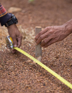
Contractors require land surveying services such as Construction Staking and As-Built surveys. Construction Staking and As-Built are required for new construction and includes the layout of survey points on the ground in relation to the plans prepared by design professionals. Construction stakes are typically placed for site control, demolition, rough grade, building layout, new utilities, walls, curbs, sidewalks and roads. As-built are typically required after construction to obtain necessary usage permits from the City and/or County. Construction staking is most often utilized by contractors, home-builders and individual homeowners.
Outer Limits Land Surveying’s Surveyors’ have been trusted to complete a variety of construction staking projects including residential and commercial subdivisions, retail shopping centers, offices, schools, churches, roads, bridges, parking lots, and sports facilities throughout the state of Arizona.